The outcome of D-Day really came down to a single weather forecast from a small group of meteorologists in June 1944. Allied weather forecasters noticed a short window of decent conditions, and that allowed 160,000 troops to storm the Normandy beaches on June 6. That moment changed the entire course of World War II. If they’d missed the mark, the biggest seaborne invasion in history could’ve ended in disaster.
Weather stations all over Britain hustled nonstop to gather the data needed for this massive call. Meteorologists used hand-drawn charts, plus reports from ships, aircraft, and even secret German weather transmissions. The Germans didn’t have access to this info, so they guessed the weather would stay too rough for any invasion.
D-Day’s story shows how weather forecasting became a weapon in its own right. The English Channel’s wild weather, heated arguments between forecasters, and the high-stakes decisions made in those days still shape how militaries plan around the weather.
Overview of the D-Day Invasion
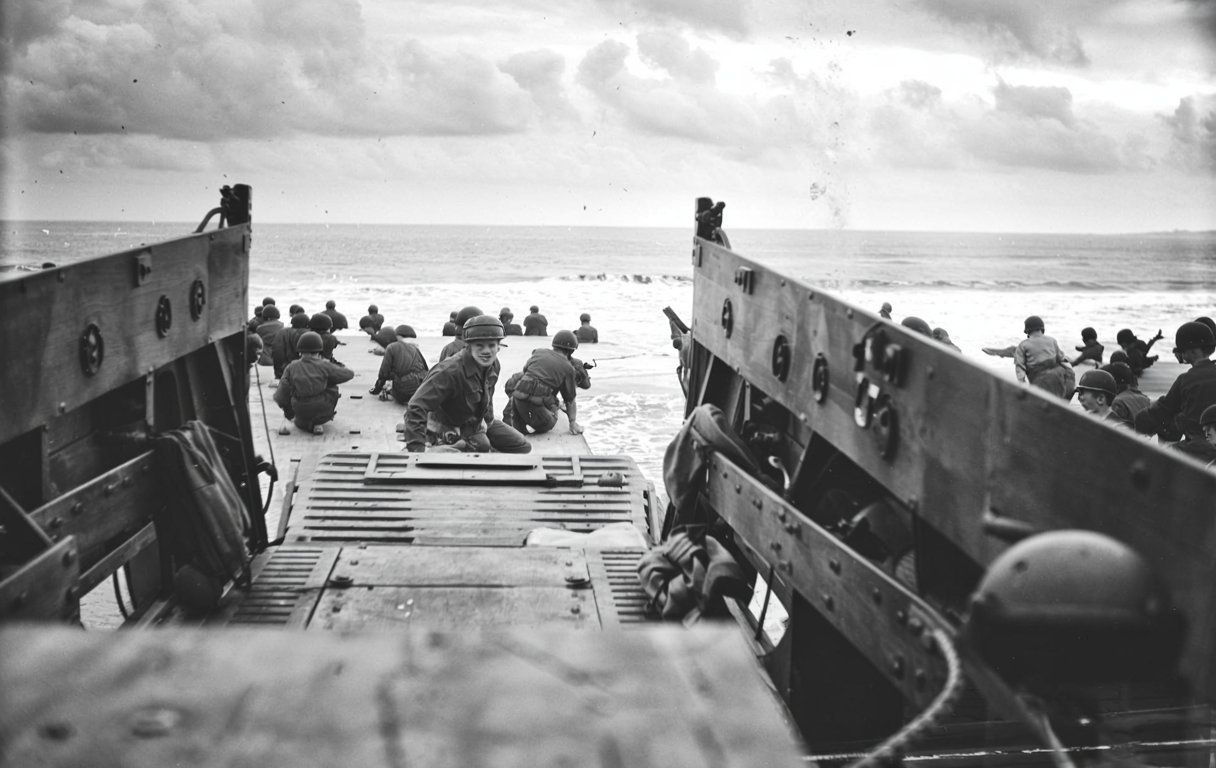
On June 6, 1944, D-Day became the largest amphibious assault ever attempted. Allied troops launched Operation Overlord to punch through Nazi-occupied France, throwing over 160,000 soldiers at a 50-mile stretch of Normandy’s coast.
Strategic Objectives and Operation Overlord
Operation Overlord aimed to open a new front in Western Europe. This would take pressure off the Soviets in the east.
The Allies wanted to grab a secure beachhead in Normandy. From there, they could push deeper into France and eventually into Germany.
Key Strategic Elements:
- Deception operations led the Germans to expect an attack at Pas-de-Calais
- Air superiority let Allied bombers hit German defenses hard
- Naval support blasted coastal fortifications
American, British, Canadian, and other Allied troops had to work together in a huge, tangled operation. General Dwight Eisenhower took charge as Supreme Allied Commander.
Surprise played a critical role. Hitler’s Atlantic Wall defenses made a direct assault nearly suicidal unless the Germans were caught off guard.
Scale and Complexity of the Allied Assault
The invasion moved more troops and gear than anything before it. Over 5,000 ships ferried forces across the Channel.
- 160,000 Allied troops landed on June 6
- 13,000 aircraft flew support missions
- 50-mile front split into five beach sectors
The Allies hit five beaches: Utah, Omaha, Gold, Juno, and Sword. Each one had its own goals and assigned units.
American soldiers attacked Utah and Omaha beaches. British and Canadian troops landed at Gold, Juno, and Sword beaches.
Airborne divisions parachuted behind enemy lines before dawn. These paratroopers grabbed bridges and cut German communication lines.
Every detail, from tides to moonlight, mattered. The planning and training took months.
Timing and Scheduling of the Invasion
The weather set the invasion date. The assault needed the right mix of tides, moonlight, and calm seas.
Allied leaders wanted to go on June 5, 1944. Bad weather forced them to wait until June 6.
Critical Weather Requirements:
- Low tide to reveal German obstacles
- Calm seas for landing craft
- Clear skies for air support
- Little wind for paratrooper drops
Delaying created huge risks. Germans could spot the buildup or the weather could get even worse.
Meteorologists found a narrow weather window on June 6. The conditions weren’t perfect, but they were just good enough.
German forecasters thought storms would continue. Their mistake left their troops off guard.
The timing made all the difference. If they’d waited for the next tide, the weather would have been far worse.
Importance of Weather Forecasting for D-Day
D-Day’s outcome depended on getting the weather just right across the English Channel. Meteorologists faced wild uncertainty in early June 1944, and Allied leaders needed a specific weather window for the invasion to have any shot.
Meteorological Challenges in Early June 1944
Forecasting in 1944 was pretty basic. Meteorologists relied on hand-drawn charts and updated them every few hours. They pulled data from ships, planes, and weather stations on land.
The Allies had a huge edge over the Germans. By breaking the Enigma code, they read German weather reports and got info from all over occupied Europe.
Allied weather data sources included:
- UK observation posts
- Ship reports from the Channel
- Air reconnaissance
- Decoded German transmissions
- Pigeons carrying weather data from ships
German meteorologists worked with a lot less data. They couldn’t break Allied codes, so their maps were missing information from Britain and nearby waters. That gap proved costly.
Group Captain James Stagg led the Allied weather team. He worked with six meteorologists—two each from the British Met Office, Royal Navy, and US Air Force. The pressure on them was enormous.
Required Conditions for Success
D-Day needed a very specific set of weather conditions. Allied leaders made a checklist for the operation. Everything on it was vital.
Essential weather conditions included:
- Winds below 15 mph for stable landing craft
- Waves under 4 feet in the Channel
- Clouds between 3,000-8,000 feet for air support
- Visibility of at least 3 miles for naval gunfire
- Low tide at dawn to spot beach obstacles
Everything had to line up perfectly along 50 miles of coast. The operation involved thousands of ships and planes, plus 160,000 soldiers.
Meteorologists also had to think about the moon. Paratroopers needed enough light to land but not so much that the Germans could see them. Tides mattered for both the first landings and the follow-up waves.
Bad weather would throw off naval bombardment. If visibility dropped, air support couldn’t fly. Rough seas could swamp landing craft or make troops too sick to fight.
Weather-Related Risks for the Operation
Bad weather threatened every part of the D-Day plan. Storms in the Channel could scatter ships and ruin the surprise. Strong winds would blow paratroopers off target.
The Allies originally picked June 5, 1944, for the attack. Forecasts showed a big storm heading for the Channel. Stagg told leaders to wait one more day.
That was a tough call. Troops were already packed onto ships and ready to go. Delaying meant holding the secret for another day while thousands sat and waited.
German forecasters said the bad weather would stick around. They figured no invasion was possible, so some high-ranking officers, like Rommel, left their posts.
Stagg noticed what the Germans missed. Allied data showed a small break in the weather on June 6. The conditions would be just barely good enough for about a day.
Weather risks the Allies faced on June 6:
- Overcast skies could limit air support
- Rough seas caused seasickness
- Strong winds made parachute drops tricky
- Visibility for naval guns wasn’t ideal
Eisenhower gave the go-ahead. Later, Stagg admitted that if they’d waited for the next tide, the Allies would’ve faced the worst Channel weather in two decades.
Meteorologists and Allied Weather Teams
Six meteorologists from three organizations worked together to make the most important weather forecast of the war. Group Captain James Stagg led this team as they decided when the Allies would launch their invasion.
Key Figures and National Meteorological Teams
Group Captain James Stagg served as Chief Meteorological Officer for Supreme Headquarters Allied Expeditionary Force. He led the weather team that advised Eisenhower.
The team had six meteorologists. Two came from the British Met Office, two from the Royal Navy, and two from the US Air Force.
Each group brought something different. The Met Office focused on land weather. Navy meteorologists knew the sea and tides. Air Force forecasters understood how weather affected planes.
Stagg had to pull together all their input into one recommendation. He then explained it to the Allied commanders. This took a lot of coordination.
Forecasting Methods and Technology of the Era
Forecasting in 1944 was hands-on. Meteorologists drew charts by hand every few hours, using whatever data they could get.
Data Sources:
- Air reconnaissance
- Ship observations
- UK land stations
- Intercepted German reports
Every station used people, not machines. Sometimes, weather observers sent reports with carrier pigeons if radios weren’t an option.
The Allies could read German weather thanks to the Enigma code. That gave them a look at weather across occupied Europe. The Germans couldn’t return the favor and had little info from British waters.
Meteorologists drew charts with pencils and paper. They plotted pressure, wind, and storm paths by hand. Their predictions only went out 24 to 48 hours.
International Collaboration and Conflict
The Allies had a big edge because they shared weather data. British and American meteorologists worked together, pooling info from both sides of the Atlantic.
German forecasters had less to work with and fewer partners. Their maps had big blank spots over the Atlantic and Britain. That made it tough to see what weather was coming.
The Allied team noticed a ridge of high pressure crossing the Atlantic. This would create a short window of better weather on June 6. The Germans missed this and kept predicting lousy conditions.
After D-Day, Stagg said that waiting would have put the Allies in the worst Channel weather in 20 years. Eisenhower replied, “Thanks, and thank the Gods of war we went when we did.”
Role of Weather Stations in Decision-Making
Weather stations in Britain and Ireland gave commanders the data they needed to make one of history’s biggest military decisions. The timing and quality of those reports helped launch the invasion on June 6, 1944.
Critical Data from Atlantic and Irish Stations
Stations along Ireland’s west coast tracked Atlantic storm systems before they hit Britain. Operators sent hourly updates on wind, pressure, and clouds. This data helped meteorologists spot a short break in the bad weather.
Key Atlantic monitoring stations:
- Blacksod Point, Ireland
- Rathfarnham, Ireland
- Prestwick, Scotland
- Gibraltar
Blacksod Point was the most important. Ted Sweeney, the operator, sent in readings every few hours. On June 4, his reports showed high pressure moving in from the Atlantic. That ridge would bring calmer seas and clearer skies.
Irish stations had a big advantage. They sat 200 miles west of the staging area. Weather moved west to east, so forecasters got 8-12 hours of warning before conditions hit the English Channel.
The Germans couldn’t get data from these western stations. They lost their Atlantic weather ships in May 1944. That left German meteorologists in the dark about incoming weather.
Observational Techniques and Communications
Operators at weather stations used simple, reliable tools. They checked mercury barometers for pressure and anemometers for wind. They estimated cloud height using balloons.
Standard observation schedule:
- Every 3 hours most of the time
- Every hour during critical moments
- Immediate reports for sudden changes
Radio operators sent coded messages to forecasting centers. They used numbers and letters to describe the weather. Sending a message usually took about 2-3 minutes.
Some remote stations used carrier pigeons as a backup. Ships at sea sometimes released pigeons with weather data if they had to keep radio silence. It was slow, but safer from German interception.
Meteorologists at headquarters plotted the data on big maps every few hours. They drew weather fronts and pressure systems by hand. These charts gave them a full picture of the weather across Western Europe.
Impact on General Eisenhower’s Choice
General Eisenhower got his weather data during daily briefings with his chief meteorologist, Group Captain James Stagg. Stagg broke down the information so military commanders could actually use it.
On June 4, weather stations warned of dangerous conditions. Winds in the English Channel blasted at 25-30 mph. Waves climbed to 4-6 feet. Rain poured down under 90% cloud cover.
The morning of June 5 brought a different story. Atlantic stations noticed the high-pressure system had started moving faster than anyone expected. Stagg told Eisenhower to expect better weather by dawn on June 6.
Eisenhower’s weather requirements:
- Wind speeds below 15 mph for landing craft
- Wave heights under 4 feet for beach operations
- Cloud cover below 70% for air support
- Visibility over 3 miles for naval gunfire
The data showed the conditions would just barely meet these standards. Eisenhower had only 30 minutes to make his decision. He decided to launch the invasion, relying on reports from Ireland and western Britain.
German meteorologists completely missed this break in the weather. They guessed storms would last through June 8. Field Marshal Rommel even left France to celebrate his wife’s birthday, sure the Allies couldn’t invade.
Weather Conditions in the English Channel
Early June 1944 brought some wild weather to the English Channel. A narrow window opened up between storms and calm, and Allied meteorologists tracked that break closely. That tiny gap made all the difference for D-Day.
June 5–6, 1944: Forecast versus Reality
Weather teams predicted stormy conditions for June 5, 1944. Strong winds and rough seas forced the Allies to call off the original invasion plan.
Forecasts warned of 25-30 mph winds and waves up to 6-8 feet. Landing craft would have been swamped, and paratroopers scattered far from their targets.
Meteorologists noticed a small weather window opening for June 6. Winds would drop to 15-20 mph, and waves would fall to 3-4 feet.
Actual conditions on June 6:
- Wind speeds: 15-25 mph (still higher than ideal)
- Wave heights: 4-6 feet
- Cloud cover: Broken clouds, with some clear patches
- Visibility: Fair to good
The forecast turned out mostly right. Conditions challenged the troops, but they managed. Paratroopers scattered in the wind, but the navy kept going.
The June Storm and Postponed Alternatives
A major storm system hit the Channel from June 4-7, 1944. This forced the Allies to delay from June 5 to June 6.
The storm hammered the Channel with 35-40 mph winds on June 5. Waves surged to 8-10 feet. Rain and low clouds would have grounded all air support.
If D-Day had gone ahead on June 5, landing craft would have capsized in those rough seas. Paratroopers would have missed their drop zones by miles.
The next good tide and moon combo wouldn’t show up until June 19. Forecasts pointed to another huge storm arriving then. That storm lasted through June 22, making an invasion impossible for weeks.
Consequences of Potential Weather Scenarios
Bad weather could’ve spelled disaster for the Allies. Rough seas would have sunk many landing craft before they even hit the beaches.
Critical weather impacts:
- Naval operations: Waves over 4 feet made beach landings extremely dangerous
- Air support: Cloud cover under 3,000 feet stopped bombing runs
- Paratroopers: Winds over 20 mph scattered troops miles off target
Actual conditions on June 6 allowed about 75% mission success, even with all the challenges. Casualties were heavy, but nothing compared to what a real storm would have caused.
German forces let their guard down because of the bad weather forecast. Many officers left their posts, thinking the invasion was impossible. This weather deception gave the Allies a huge advantage.
Lasting Impact of Meteorological Decisions on History
The D-Day weather forecast changed how military leaders think about meteorology and shaped modern forecasting. That single decision showed the real power of weather data and drove big advances in atmospheric science.
D-Day’s Unique Place in Weather Forecasting
The D-Day forecast is probably the most important weather prediction in military history. Group Captain James Stagg and his team made a call that changed the course of World War II.
Key factors that made this forecast unique:
- First time weather decided the timing of a major invasion
- Required teamwork between multiple Allied weather services
- Combined classic observations with captured German data
- Relied on probability-based forecasting under huge pressure
The Allied advantage came from breaking the German Enigma code. Meteorologists got access to German weather reports, while keeping their own data secret. German forecasters missed out on key Atlantic information.
Stagg’s team found that brief weather window on June 6, 1944. German meteorologists missed it because they couldn’t see the Atlantic data. The invasion’s success owed a lot to that forecasting edge.
Stagg later pointed out that waiting would have meant facing the worst Channel weather in 20 years. General Eisenhower wrote back, “Thanks, and thank the Gods of war we went when we did.”
Post-War Developments in Meteorology
D-Day’s success pushed major changes in weather forecasting after 1945. Military leaders realized meteorologists needed better tools and training.
Technological advances included:
- Radar systems for tracking storms
- Upper-atmosphere balloon programs
- Early computer modeling systems
- Satellite weather monitoring
The World Meteorological Organization formed in 1950. This brought global teamwork in sharing weather data. Countries learned that accurate forecasts needed international cooperation.
Weather stations popped up everywhere. The military poured money into atmospheric science research. Universities created new meteorology programs to train the next wave of forecasters.
Probability forecasting became the norm. Before D-Day, forecasters just gave yes-or-no answers. After seeing Stagg’s success with probability estimates, the field shifted to more nuanced predictions.
By the 1960s, computer technology had changed everything. Mathematical models replaced hand-drawn weather charts. Forecasters could process way more data than the D-Day team ever dreamed.
Lessons for Modern Military Operations
These days, military operations still lean pretty heavily on weather forecasting. The lessons from D-Day? They’re still guiding military meteorologists everywhere.
The Met Office Mobile Met Unit actually goes out with British forces. These teams show up on-site to give weather support during exercises and real combat. They stick to the same principles Stagg used back in 1944.
Modern military meteorologists get training in both atmospheric science and military procedures. They know how weather can mess with different weapons systems or change tactical situations.
Current applications include:
- Aircraft mission planning
- Naval operations timing
- Ground troop movement decisions
- Equipment performance predictions
Military commanders took D-Day’s lesson to heart—weather forecasting needs dedicated resources. Every big military base now keeps trained meteorologists on staff.
Now, they blend weather intelligence right into operational planning. Military leaders won’t make major decisions without checking with weather experts first.
Satellite technology gives modern forecasters a huge edge Stagg’s team never had. Still, the main idea stays the same: having accurate weather info gives you a real tactical advantage over enemies who don’t.

