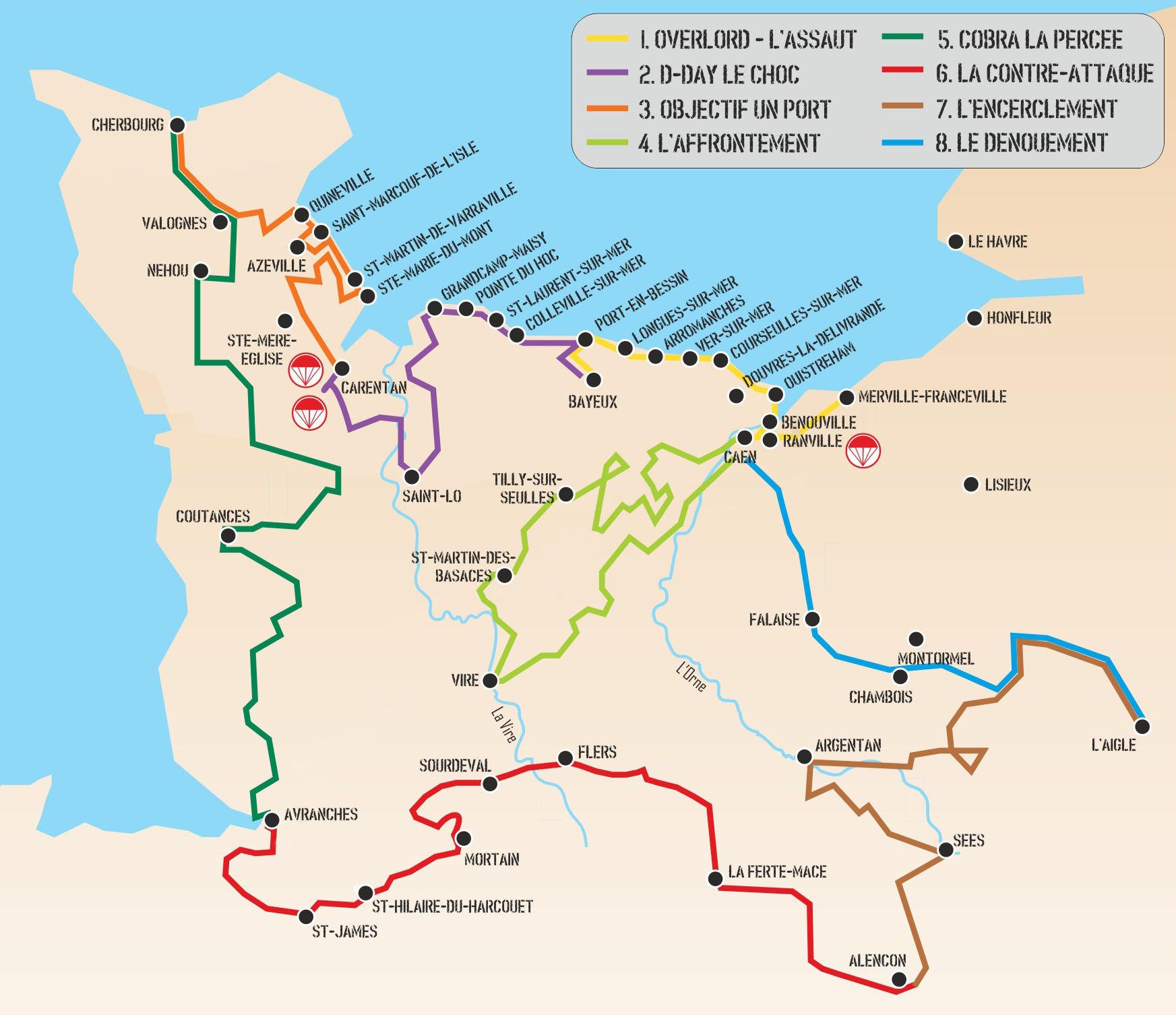
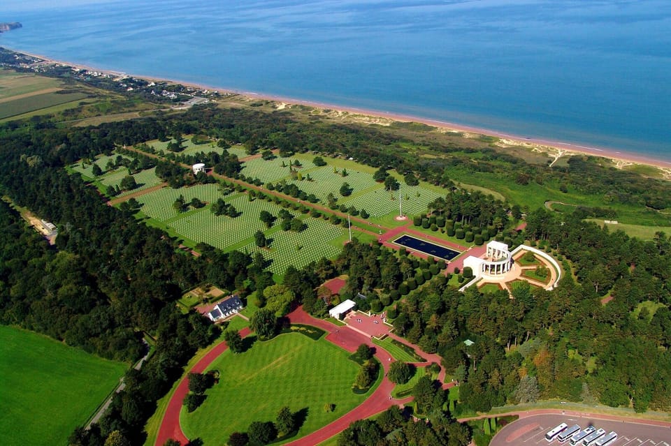
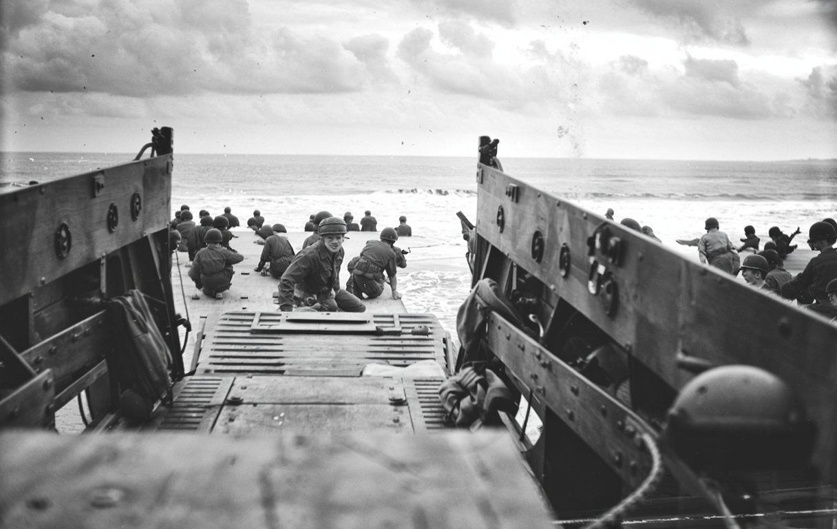
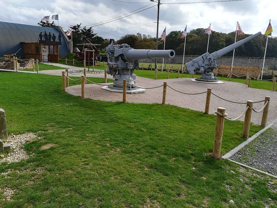
D-Day’s success really hinged on picking the right stretch of French coastline for the largest seaborne invasion ever attempted. Allied commanders spent months poring over maps and studying the geography of possible landing sites along the French coast.
They needed beaches that could handle massive troop landings while still offering strategic advantages for the assault on Nazi-occupied Europe.
The geography of Normandy‘s coastline brought together wide sandy beaches, manageable tides, and defensive positions that made Operation Overlord possible. The region offered long stretches of accessible shoreline where landing craft could deliver troops and equipment.
The beaches sat close enough to Britain for Allied air support, but far enough from the heavily fortified German positions at major ports.
When you look at how geography shaped D-Day planning, you see just how much military strategy had to balance with natural features. The landscape influenced everything from naval operations to supply lines.
Allied teams gathered intelligence about coastal depths, tides, and terrain—these details became critical and determined the invasion’s timing and, honestly, its chances of success.
Strategic Importance of the French Coastline in D-Day Planning
The French coastline gave the Allies some real advantages that shaped their invasion strategy in World War II. Military planners checked out beach conditions, defensive positions, and the distance from English bases to pick the best landing zones for the operation.
Geographic Factors Influencing Site Selection
The French coast had all sorts of terrain that directly impacted invasion plans. Wide sandy beaches were absolutely essential for landing lots of troops and heavy equipment.
Normandy’s coastline offered broad, flat beaches that worked for amphibious landings. These beaches could take thousands of soldiers and armored vehicles at once.
The gentle slopes made it possible for landing craft to get close to shore without too much trouble.
Key geographic advantages included:
- Sandy beaches with solid footing for troops
- Enough width for several landing zones
- Low tidal ranges for steady operations
- Natural harbors for supply operations
Tidal patterns along the Norman coast provided conditions the Allies could count on. Planners needed specific tide levels for landing craft to work. High tide let boats get past beach obstacles, but low tide exposed German barriers.
The terrain behind the beaches changed a lot from place to place. Some spots had gentle inclines that troops could cross quickly.
Other stretches had steep cliffs, which gave German forces strong defensive positions.
Coastal geography also shaped naval support. Deep water offshore meant big warships could move in and provide bombardment during the landings.
Proximity to Allied Bases and the English Channel
The distance from British ports played a huge part in picking the landing sites. The English Channel gets pretty narrow in spots, which cut travel time and saved fuel for the invasion fleets.
Normandy sits about 100 miles from southern England. That distance let landing craft make several trips in a single day.
Shorter crossings meant faster reinforcement and resupply.
Strategic proximity benefits:
- Less fuel needed for ships
- Faster troop rotations
- Better air support coverage
- Easier logistics
Fighter planes based in Britain could cover the Norman beaches. Since World War II aircraft had limited range, being close really mattered for keeping up air support.
Naval ships could head back to English ports for repairs and resupply without too much delay. This ability helped the Allies keep up continuous support as the invasion went on.
The short crossing also meant less seasickness for the troops. Calmer waters in the narrower channel made soldiers more ready when they hit the beach.
Comparative Analysis of Potential Landing Sites
Allied planners checked out several coastal locations before settling on Normandy. Each site had its own mix of pros and cons.
The Pas-de-Calais region gave the shortest channel crossing. Unfortunately, German forces had packed it with defenses, making landings there almost impossible.
Dieppe had already seen a raid in 1942 that ended with heavy Allied losses. That experience showed how tough steep beaches and strong defenses could be.
Comparison of major sites:
- Pas-de-Calais: Closest, but most heavily defended
- Dieppe: Tested, but too tough
- Normandy: Moderate distance with lighter defenses
- Brittany: Nice beaches, but too far from English bases
The Brittany peninsula had great beaches, but it was just too far away. Long supply lines would have made it hard to keep operations going.
German defenses weren’t the same everywhere. Intelligence reports showed Normandy had fewer fortifications than other areas.
Normandy as the Chosen Landing Area
Military leaders picked Normandy after weighing all the geographic and strategic factors. The region brought together good beaches and defenses that seemed manageable.
The Norman coast offered five separate beach areas for landings all at once. Utah, Omaha, Gold, Juno, and Sword beaches each played a specific role in the invasion plan.
German defenses in Normandy weren’t as strong as in other places. The Germans expected the main invasion at Pas-de-Calais, so they left Normandy a bit under-defended.
The coastline’s geography also allowed for artificial harbors. Allied engineers could set up ports to handle the huge supply needs after landing.
Final selection factors:
- Several suitable landing beaches
- Weaker German defenses
- Reasonable distance from English bases
- Room and potential for harbor construction
The terrain inland from the beaches gave the Allies chances to expand quickly. They could set up secure beachheads and push toward strategic objectives before the Germans could react.
Physical Geography and Topography of the Normandy Beaches
The Normandy coastline brought some real geographic challenges that needed careful analysis before D-Day. The beaches were all different, tidal patterns created narrow windows for landings, and natural defensive positions dominated key areas.
Beach Characteristics and Landing Zones
The Normandy beaches ran along a 50-mile section of the English Channel. Each landing zone had its own physical quirks that shaped tactical choices.
Utah Beach gave the Allies wide sandy flats, but flooded marshlands sat just behind. The Germans flooded these areas on purpose to slow down attackers. Still, the beach itself had firm sand that worked for vehicles and landing craft.
Omaha Beach was the toughest. High bluffs, about 100 feet tall, rose above a narrow strip of sand. German defenders could see everything and had strong firing positions. The beach measured only 300 yards at low tide.
Gold Beach had a mix of sand and clay. Rocky outcrops broke up the coastline. At low tide, the beach widened a lot, giving more space for landings.
Juno Beach offered sandy spots with rocky patches and seawalls. Small resort towns dotted the area. The slope of the beach was easier than Omaha, which helped.
Sword Beach came with wide sandy areas great for big landings. Dunes inland gave some cover. The Orne River estuary added some extra geographic twists on the eastern side.
Impact of Tides and Coastal Currents
Tidal patterns along Normandy’s coast created strict timing for the invasion. The English Channel has big tidal swings, and that affected landings.
Low tide exposed huge stretches of beach but also revealed German obstacles and mines. High tide covered those, but left less room to land. Planners wanted a rising tide so they could float damaged landing craft back off the beaches.
The best conditions meant low tide at dawn, so teams could see and clear obstacles. This only happened a few days each month. Tidal currents running along the coast could push landing craft off course.
Tidal Considerations:
- Low tide: 300-yard beach at Omaha
- High tide: 50-yard beach at Omaha
- Best time to land: Two hours after low tide
- Currents: Up to 3 knots along the shore
Strong currents especially messed with the American sectors. Many landing craft drifted east of where they were supposed to land. This made it harder to keep units together, but it also threw off German defenders.
Cliffs, Natural Obstacles, and Defensive Positions
The Norman coast’s natural features gave the Germans built-in defensive positions. Planners had to deal with these geographic advantages.
Pointe du Hoc stood between Utah and Omaha beaches. This rocky promontory rose 100 feet above the sea, and German artillery there could hit both American landing zones.
Omaha Beach’s bluffs worked like fortress walls. Five draws—small valleys—cut through the cliffs, and these were the only ways vehicles could get inland. Germans fortified each draw with bunkers and obstacles.
The bocage country started just inland from the beaches. These old field boundaries made natural defensive lines, with high earthen banks and thick hedges splitting up the ground.
Coastal villages gave more defensive spots. Stone buildings provided cover and places to watch for attackers. Germans made these structures part of their defensive system.
Marshes behind Utah Beach forced troops onto narrow causeways. These bottlenecks became key targets for paratroopers before the main assault.
Comparison of Pebble and Sandy Beaches
Beach makeup really affected how landings went and how vehicles moved. Sandy beaches usually helped the Allies, but pebble beaches brought their own headaches.
Sandy Beach Advantages:
- Firm footing for infantry
- Good traction for tanks and trucks
- Easier to clear obstacles
- Better drainage
Pebble Beach Challenges:
- Unstable for heavy vehicles
- Harder for troops to move
- Wheels and tracks slipped
- Noisy underfoot
Most Normandy beaches had sand from rivers flowing into the Channel. The Calvados plateau’s limestone added calcium carbonate to the mix, along with quartz sand and shell fragments.
Some areas had pebble banks above the high-tide line. Engineers had to lay down steel mats and build roads to get vehicles across these spots.
Beach slope mattered too. Gentle slopes let landing craft get right up to the shore. Steep slopes caused boats to get stuck too far out or tip over in the surf.
The sand’s strength determined what vehicles could operate on the beaches. Engineers tested samples to make sure Sherman tanks and heavy gear wouldn’t just sink.
Hydrographic and Intelligence Operations
Allied planners needed detailed knowledge of Norman coastal waters to pull off the invasion. The British Hydrographic Office led massive mapping efforts, and covert teams gathered crucial intelligence on German defenses.
Reconnaissance and Mapping During Planning
The British Hydrographic Office started collecting data for D-Day years before the invasion. Cartographers mixed French charts with captured German naval records.
They created custom maps showing water depths, coastal features, and defensive positions.
Allied forces needed solid info on tide patterns and underwater obstacles. Hydrographic data showed where landing craft could safely approach.
Planners mapped out the best routes for the invasion fleet, which, by the way, included over 4,000 vessels.
Key mapping elements included:
- Water depths at different tides
- Underwater rocks and sandbars
- German defenses
- Artillery positions and ranges
- Safe channels for navigation
By D-Day, the office had produced over 1.5 million specialized charts. Every vessel got maps tailored to their route and landing zone.
Role of Hydrographic Data in Navigational Decisions
Hydrographic surveys shaped when and where the Allies landed in Normandy. Planners needed to know if landing craft could get close enough to shore and avoid German obstacles.
The data showed some beaches had gentle slopes that worked for amphibious assaults. Others had steep drop-offs or rocky bottoms that could trap boats. This info helped commanders pick the final landing sites.
Naval bombardment ships used these charts to find the best spots for shelling German positions. Charts told them exactly where they could anchor and still provide effective cover fire.
Tide tables played a huge role in timing the assault. The Allies needed enough water to clear obstacles, but not so much that troops would be forced to wade through deep water when landing.
Use of Covert Operations for Intelligence Gathering
Back in August 1943, Operation Neptune kicked off with a goal: gather secret coastal intelligence. Two Royal Navy officers, Lieutenant Commander Berncastle and Lieutenant Glen, left the Isle of Wight in small landing craft to check out French beaches at night.
They needed certain conditions, like dark, moonless nights and high tides just before dawn. The teams crossed the Channel in low-profile boats with silenced engines.
They moved fast, did their surveys, and got back before sunrise to dodge German patrols.
Mission parameters:
- Departure time: Just before midnight
- Return deadline: 4:00 AM
- Equipment: 32-foot landing craft and canoes
- Weather requirements: Dark nights with no moon
The surveyors measured water depths and mapped out German defenses. They also scooped up soil samples to see if the beaches could handle heavy equipment.
Once, German forces spotted them, but the team managed to escape.
X-craft submarines joined in, running underwater reconnaissance missions. These tiny subs checked shoreline depths and snapped photos of German beach defenses from offshore.
Influence of Geography on Allied Logistics and Supply Lines
The French coastline was a mixed bag for Allied supply operations during the Normandy landings. Planners had to work around tidal ranges, beach gradients, and whatever port facilities already existed to set up logistics across the Channel.
Planning Supply Routes and Lines of Communication
Allied planners pored over detailed maps of the Norman coast to find the best supply corridors. The OMAHA and UTAH beach sectors each had their own logistical perks, depending on the terrain.
The 20-foot tidal range at Normandy meant only short windows for supply deliveries. Planners timed major supply runs with high tide so landing craft could get closer to shore.
Beach gradients varied a lot. Some sectors had gentle slopes, letting trucks drive right onto the sand. Steeper spots needed special equipment to haul supplies inland.
The bocage countryside behind the beaches created natural barriers for communication lines. Planners had to pick out key roads and railways that could handle heavy supply traffic once secured.
Weather in the Channel threw curveballs at supply timing. Strong winds and storms sometimes shut down beach operations for days. Allied forces built weather contingencies into their logistics schedules, just in case.
Challenges for Landing Craft and Transport
Rocky outcrops and sandbanks made navigation a nightmare for supply vessels. The Calvados reef system forced ships to approach beaches through narrow channels at very specific angles.
Tidal changes kept exposing new problems. High tide meant landing craft risked hidden rocks, while low tide left them stuck in soft sand.
Beach capacity set a hard limit on how many vessels could unload at once. Each sector could only handle a certain tonnage per day, depending on its width and surf.
Strong currents near shore often pushed landing craft off course. Crews really needed local know-how to get through safely.
Storms regularly battered the beaches and messed up operations. High waves shifted sand and created new obstacles. Supply schedules always had to allow for weather delays and equipment repairs.
Establishment of Temporary Ports and Infrastructure
With no usable ports, Allied engineers had to get creative and build artificial harbors. Mulberry harbors took advantage of the coastline’s natural shelter and let bigger ships unload supplies.
Geography dictated where they could put these harbors. Sites needed protection from winds and enough water depth. Arromanches and Saint-Laurent ended up being the best choices.
Beach exits quickly became vital infrastructure points. Engineers built corduroy roads through soft sand, using whatever local materials they could find.
Fuel supply called for its own solutions. PLUTO underwater pipelines crossed the Channel at its shortest points. Coastal features helped hide these lines from enemy detection.
Railway connections linked up coastal supply points with inland operations. French rail networks shaped how they built new infrastructure. Bridges and tunnels at geographic chokepoints became top repair priorities.
Naval Considerations and Minefield Challenges
Allied planners had to tackle huge naval obstacles before D-Day. German minefields stretched across the Channel, and coastal gun batteries waited for any fleet approaching Normandy.
Navigating Channel Minefields and Defenses
By June 1944, the English Channel held over 6,000 German mines. These blocked direct routes to the French coast.
Allied minesweepers spent weeks clearing paths before D-Day. They opened up ten separate channels through the minefields, each 400 to 1,200 yards wide.
Key mine types included:
- Contact mines that exploded on impact
- Magnetic mines triggered by metal hulls
- Acoustic mines set off by engine noise
German coastal batteries added another layer of danger. These guns could hit ships from miles away. The batteries at Pointe du Hoc controlled the approaches to Omaha Beach.
Allied forces used deception to throw off German defenders. They faked radio traffic to suggest landings at Pas-de-Calais, keeping many coastal guns pointed at the wrong beaches.
Strategic Use of Naval Bombardment
Naval guns played a huge role during the invasion. Over 200 Allied warships gathered off Normandy on June 6th.
Battleships like HMS Warspite fired shells weighing more than 1,500 pounds. These guns could smash concrete bunkers from 15 miles out.
The bombardment started at 5:50 AM. Ships aimed at German artillery and beach defenses. This lasted about 40 minutes before troops hit the shore.
Naval fire support included:
- Battleships for heavy bunkers and gun positions
- Cruisers for medium fortifications
- Destroyers for close-range support
Some areas didn’t get as much naval fire as planned. Bad weather limited visibility at Omaha Beach, so a lot of German positions survived the initial attack.
Interaction Between Geography and Naval Operations
Normandy’s geography shaped every naval move. Wide sandy beaches let landing craft reach shore safely.
Tidal ranges of 20 feet made timing tricky. Ships had to match their approaches to the tide. Too low, and they’d get stuck on sandbars. Too high, and they’d have a longer, more dangerous run across open beach.
The Calvados plateau behind the beaches gave German spotters perfect vantage points. They could call in artillery fire on ships offshore.
Rocky spots like Pointe du Hoc needed special assault teams. Navy destroyers risked coming as close as 1,000 yards from the cliffs to provide support.
Shallow water near the beaches limited which ships could get close. Battleships stayed farther out, while destroyers and gunboats moved in to help troops directly.
The bocage countryside inland blocked naval gunfire support after D-Day. Ships could only back up troops within a few miles of the coast.
Lasting Impact of the French Coastline on D-Day and World War II
The French coastline’s unique geography shaped the immediate outcome of D-Day and changed how armies plan amphibious assaults. These coastal features taught some hard lessons that transformed military thinking about coastal operations.
Operational Successes and Coastal Challenges
The Normandy beaches proved just how much coastal geography can decide an invasion’s success. Omaha Beach had steep cliffs and strong German defenses, causing heavy Allied casualties. Utah Beach had gentler slopes and weaker defenses, so troops moved inland faster.
Beach width also made a big difference for landing equipment. Wide beaches like Gold and Juno let tanks and vehicles deploy quickly. Narrow spots created bottlenecks and slowed everything down.
Tidal patterns along the coast forced tough timing decisions. Low tide exposed German obstacles but meant longer runs across open sand. High tide hid obstacles but brought landing craft closer to enemy fire.
The bocage countryside behind the beaches threw up unexpected problems. Dense hedgerows stopped tanks and gave German defenders an edge. Planners had focused on beach defenses but didn’t realize how tough the inland terrain would be.
Cliffs at Pointe du Hoc showed just how much elevation matters. Rangers scaled 100-foot cliffs under fire to take out German guns. That proved vertical terrain can multiply defensive strength.
Post-Invasion Military Geography Lessons
D-Day forced military planners to rethink coastal warfare. Beach gradient became a top factor for future invasions. Steep beaches like Omaha needed special gear and more prep time.
Weather patterns suddenly mattered a lot more. Normandy’s unpredictable June weather almost pushed D-Day back. Leaders learned that coastal weather had to drive operational timing.
Allied forces came up with new ways to spot coastal defenses. Aerial photos revealed German positions all along the French coast. These techniques became standard in later Pacific campaigns.
Capturing harbors became a top priority for sustained operations. The Allies built Mulberry artificial harbors because Normandy lacked deep-water ports. Later invasions focused on capturing real harbors as soon as possible.
Inland transportation networks turned out to be as important as the beaches themselves. Norman roads and railways decided how fast troops could move after landing. Geographic intelligence grew to include mapping infrastructure, not just terrain.
Legacy of the Normandy Landings in Military Planning
Modern amphibious warfare still borrows principles from the Normandy landings. Military academies actually use D-Day as their go-to example for big coastal operations.
The invasion proved that if you throw enough force at a problem, you can get past some pretty serious geographic disadvantages. After D-Day, coastal reconnaissance grew into a specialized military science.
Intelligence teams started looking at more than just enemy positions. They cared about tide tables, what the beaches were made of, and even the best inland routes.
The French Resistance played a huge part here, providing geographic intelligence that honestly saved a lot of Allied lives. Planners in World War II came up with new ways to classify invasion beaches.
Sandy beaches let vehicles move easily, but rocky shores forced them to use different gear. These categories still influence how militaries plan operations today.
NATO actually builds its coastal defense strategies around D-Day lessons. European commanders pay close attention to how German troops used Norman geography for their defenses.
That kind of thinking shapes how modern fortifications get designed along important coastlines. Military schools around the world still use Norman coastal maps for teaching the basics of invasion planning.
It’s kind of wild how much those old maps and strategies still matter.

